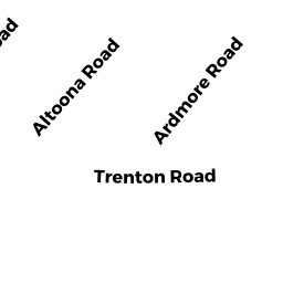
62 TRENTON RD 2
Owner Information
BECKER MATTHEW ETUX
62 TRENTON RD 2
DEDHAM, MA 02026


Property Details
62 TRENTON RD 2 is classified as a Condo NL MDL-05 (Condominium).
The primary structure on this property was built in 2001. There are 1,192ft2 of built area within this property. There is 1,092ft2 of residential/living space within this property. This property is listed as having 5 rooms.
62 TRENTON RD 2 is valued at $360,100. The land is valued at $0 and the structures are valued at $360,100.
This property is in Zone G. Confirm with local Zoning Board authorities to ensure there are no overlays or other easements on this property.
The most recent deed for 62 TRENTON RD 2 is recorded at the local registrar in Book 34151, Page 180. 62 TRENTON RD 2 was last sold on Tuesday, June 7, 2016 for $349,900.
Assessment data from fiscal year 2020.
Flood Data
This property is partially within the AE Zone (within floodplain). Approximately 0.15 acres (33.98%) of the property is within this zone.
This information is sourced from the FEMA National Flood Hazard Layer. See our full disclamer.
Broadband Internet Providers
| Provider | Type | Bandwidth (mbps) | |
|---|---|---|---|
| VSAT Systems, LLC. | Satellite | 2 | 1 |
| Viasat Inc | Satellite | 100 | 3 |
| Comcast | Cable | 1000 | 35 |
| Verizon New England Inc. | Fiber | 940 | 880 |
| RCN | Cable | 500 | 20 |
| GCI Communication Corp. | Satellite | 0 | 0 |
| HughesNet | Satellite | 25 | 3 |
Broadband service provider data from December 2020.